 NERC Data Catalogue Service
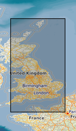
Aerial geophysical surveys
Type of resources
Available actions
Topics
Keywords
Contact for the resource
Provided by
Years
Formats
Representation types
Update frequencies
Service types
Scale
-
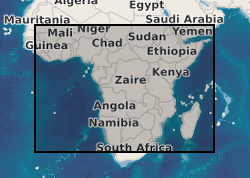
Data from geophysical surveys in many African countries carried out by the British Geological Survey for different agencies. The surveys range from regional gravity and airborne magnetic mapping to targetted surveys for mineral and water. Individual surveys do not yet have metadata entries: this entry describes a notional database that represents all geophysical surveys carried out within the region.
-
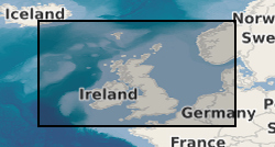
High Resolution, Airborne Magnetic, Radiometric, VLF Survey over north Midlands of GB. Survey flying for the collaborative BGS and World Geoscience Corporation Ltd (WGC) high resolution geophysical and environmental survey was completed in early September 1998. The data comprise multi-channel gamma ray spectrometer, magnetometer and dual frequency VLF-EM. Flight line spacing was 400 m with tie lines at 1200 m and the total area surveyed is some 14 000 km2. Flight-line orientations are W–E over the western survey area, SW–NE over the eastern area. Ground clearance was maintained at 90 m in rural areas, increasing to about 240 m in built-up zones.
-
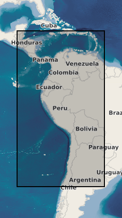
Data from geophysical surveys in many South American and Caribbean countries carried out by the British Geological Survey for different agencies. The surveys range from regional gravity and airborne magnetic mapping to targetted surveys for mineral and water. Individual surveys do not yet have metadata entries: this entry describes a notional database that represents all geophysical surveys carried out within the region.
-
Analogue aeromagnetic surveys of Great Britain for the Geological Survey (GSGB), subsequently digitised. Commercial Analogue survey of North Sea by Aerosurveys Inc, subsequently digitised by BGS. Commercial digital (+ one analogue) surveys off NW/N/NE of Britain by Huntings Geology and Geophysics and ESL, purchased outright by BGS. Local surveys, digital and analogue aeromagnetic (+ other methods) surveys for BGS and commercial companies. Data acquired over many years by different companies. Surveys vary from High Resolution helicopter covering a few square kms to regional surveys covering 1000s of square kms. Some data recorded analogue, subsequently digitised, other data full digital capture with GPS navigation. Approximately 75% of the bounding rectangle covered. Flight line separation varies between 2km and 0.4km, line spacing typically 2km over UK but 0.4km over Devon/Cornwall. Flight line separation for Aerosurveys/Huntings surveys vary between 6.4 to 15 km. Detailed surveys at various resolutions. Along line spacing varies, analogue data: digitised from 1:63 360 and 1:253 440 scale map sheets and digital surveys: Decca navigation, 305m asl (above sea level). Local helicopter surveys, analogue and digital recordings, various survey heights. HiRES survey, full digital data capture at 0.1 sec intervals, GPS navigation, 90m survey height.
-
Digitised version of aeromagnetic survey records of Great Britain comprising a record for each digitised point, supported by survey and 'ends and bends' based line indexes. Original records include flight line records, worksheets, contour sheets and air photos provided by contractors at completion of each survey. Worksheets digitised by BGS during 1980's Smith and Royles 1989.